About: Namcha Barwa Himal     Goto   Sponge   NotDistinct   Permalink

An Entity of Type : dbo:Settlement, within Data Space : dbpedia.demo.openlinksw.com associated with source document(s)
QRcode icon
http://dbpedia.demo.openlinksw.com/describe/?url=http%3A%2F%2Fdbpedia.org%2Fresource%2FNamcha_Barwa_Himal&invfp=IFP_OFF&sas=SAME_AS_OFF

Namcha Barwa Himal, also known as Namjagbarwa syntaxis or Namjagbarwa Group Complex, is the easternmost section of the Himalaya in southeastern Tibet and northeastern India. This section spans 180 km from the headwaters of the Siyom River on the international border NE into Tibet to the canyon of the Yarlung Tsangpo (the Brahmaputra in India), where the Himalaya are said to end, although high ranges (Hengduan Mountains on China–Myanmar border) actually continue another 300 km east. Major peaks of this section include:

AttributesValues
rdf:type
rdfs:label
  • Namcha Barwa Himal (ca)
  • Namcha Barwa Himal (en)
rdfs:comment
  • La Namcha Barwa Himal, també coneguda com a Namjagbarwa syntaxis o Namjagbarwa Group Complex, és la secció més oriental de l' Himàlaia, al sud-est del Tibet i al nord-est de l'Índia. Aquest tram de l'Himàlaia s'estén al llarg de 180 km, des de la capçalera del riu Siyom, a la frontera entre el Tibet i l'Índia i la fi del congost del Yarlung Tsangpo. Els principals cims d'aquesta serralada són: El Gyala Peri, de 7.294 m, està situat a 22 km al NNW del Namche Barwa, a l'altra riba del Yarlung Tsangpo, i per tant formant part de la , però sovint és inclòs en aquesta serralada per la proximitat. (ca)
  • Namcha Barwa Himal, also known as Namjagbarwa syntaxis or Namjagbarwa Group Complex, is the easternmost section of the Himalaya in southeastern Tibet and northeastern India. This section spans 180 km from the headwaters of the Siyom River on the international border NE into Tibet to the canyon of the Yarlung Tsangpo (the Brahmaputra in India), where the Himalaya are said to end, although high ranges (Hengduan Mountains on China–Myanmar border) actually continue another 300 km east. Major peaks of this section include: (en)
name
  • Namcha Barwa Himal (en)
geo:lat
geo:long
foaf:depiction
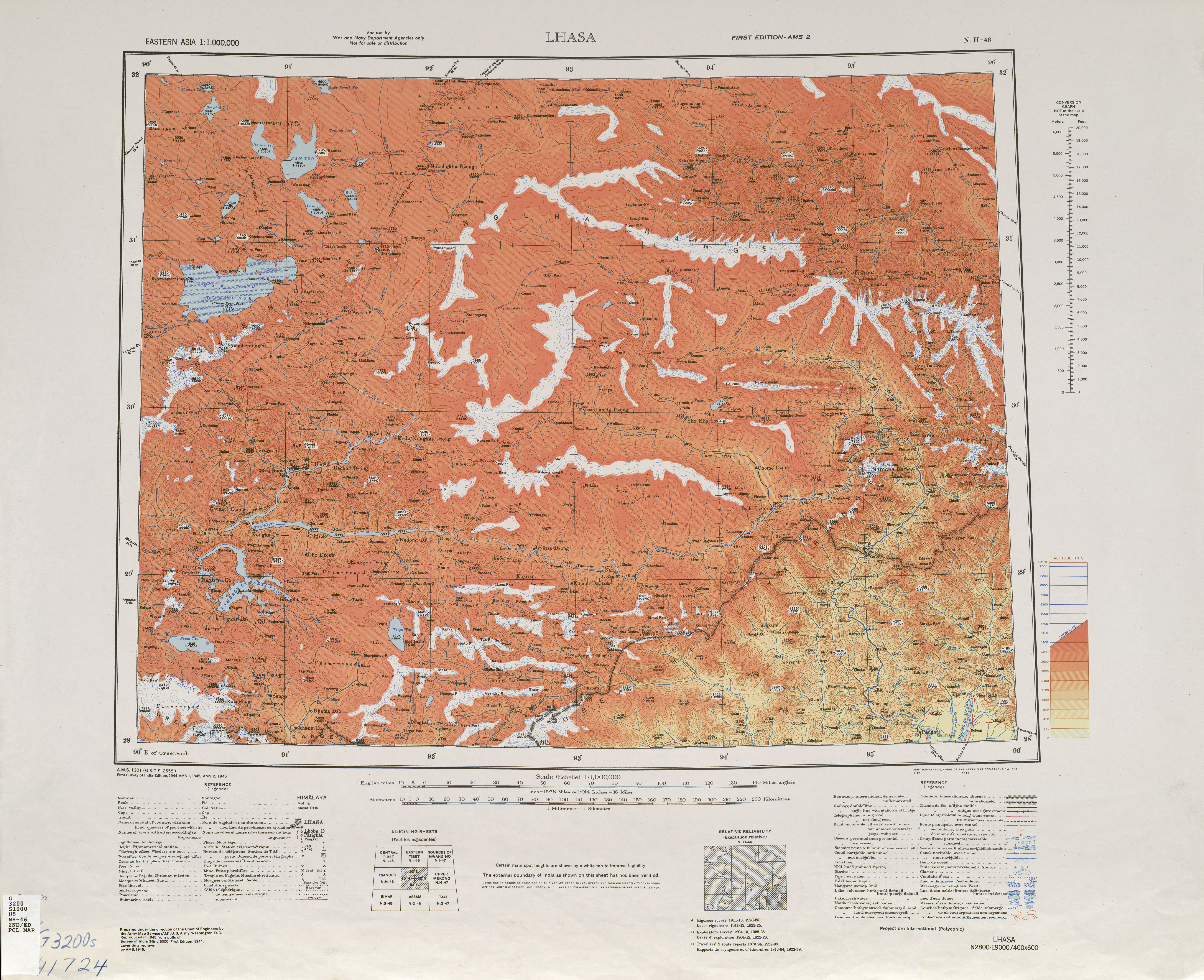
  • http://commons.wikimedia.org/wiki/Special:FilePath///www.lib.utexas.edu/maps/imw/txu-oclc-6654394-nh-46-2nd-ed.jpg
  • http://commons.wikimedia.org/wiki/Special:FilePath/Yarlung_Tsangpo_river_tibet.jpg
dcterms:subject
Wikipage page ID
Wikipage revision ID
Link from a Wikipage to another Wikipage
Link from a Wikipage to an external page
  • http://www.lib.utexas.edu/maps/imw/txu-oclc-6654394-nh-46-2nd-ed.jpg
sameAs
dbp:wikiPageUsesTemplate
thumbnail
location
other name
  • Namjagbarwa (en)
photo
  • Yarlung Tsangpo river tibet.jpg (en)
photo caption
  • Satellite view of Namcha Barwa Himal range surrounded by Great Bend of the Yarlung Tsangpo River . Namcha Barwa Himal range runs diagonally from bottom left to top right corner, and Naamcha Barwa peak is in the top right at the end of the range. Gyala Peri peak in the Nyenchen Tanglha Shan range is just 20 km north of Naamcha Barwa peak across the Yarlung Tsangpo River. (en)
georss:point
  • 29.629166666666666 95.05583333333334
has abstract
  • La Namcha Barwa Himal, també coneguda com a Namjagbarwa syntaxis o Namjagbarwa Group Complex, és la secció més oriental de l' Himàlaia, al sud-est del Tibet i al nord-est de l'Índia. Aquest tram de l'Himàlaia s'estén al llarg de 180 km, des de la capçalera del riu Siyom, a la frontera entre el Tibet i l'Índia i la fi del congost del Yarlung Tsangpo. Els principals cims d'aquesta serralada són: * Namcha Barwa, 7,782 m * Sanglung, 7.090 m a 29°40"N, 95°08'00"E, no escalada * Nai Peng, 7.043 m a 29°37'12"N, 95°03'00"E, escalat per primera vegada el 1984 * Sentang Bu, 6.812 m a 29°49'48"N, 95°00'36"E, No escalat El Gyala Peri, de 7.294 m, està situat a 22 km al NNW del Namche Barwa, a l'altra riba del Yarlung Tsangpo, i per tant formant part de la , però sovint és inclòs en aquesta serralada per la proximitat. (ca)
  • Namcha Barwa Himal, also known as Namjagbarwa syntaxis or Namjagbarwa Group Complex, is the easternmost section of the Himalaya in southeastern Tibet and northeastern India. This section spans 180 km from the headwaters of the Siyom River on the international border NE into Tibet to the canyon of the Yarlung Tsangpo (the Brahmaputra in India), where the Himalaya are said to end, although high ranges (Hengduan Mountains on China–Myanmar border) actually continue another 300 km east. Major peaks of this section include: * Namche Barwa, 7,782 m at 29°37′45″N 95°03′21″E / 29.62917°N 95.05583°E, considered easternmost syntaxis of Himalaya * Nai Peng, 7,043 m at 29°37′12″N 95°03′00″E / 29.62000°N 95.05000°E, first climbed 1984 * Sentang Bu, 6,812 m at 29°49′48″N 95°00′36″E / 29.83000°N 95.01000°E, unclimbed * Gyala Peri, 7,294 m at 29°48′51″N 94°58′06″E / 29.81417°N 94.96833°E, part of Nyenchen Tanglha Shan range, stands about 22 km NNW of Namche Barwa, across the Yarlung Tsangpo but often included in the Namche Barwa Himal range because of proximity. (en)
gold:hypernym
prov:wasDerivedFrom
page length (characters) of wiki page
foaf:isPrimaryTopicOf
geo:geometry
  • POINT(95.05583190918 29.629167556763)
is Link from a Wikipage to another Wikipage of
is Wikipage redirect of
is range of
is mountain range of
is foaf:primaryTopic of
Faceted Search & Find service v1.17_git139 as of Feb 29 2024


Alternative Linked Data Documents: ODE     Content Formats:   [cxml] [csv]     RDF   [text] [turtle] [ld+json] [rdf+json] [rdf+xml]     ODATA   [atom+xml] [odata+json]     Microdata   [microdata+json] [html]    About   
This material is Open Knowledge   W3C Semantic Web Technology [RDF Data] Valid XHTML + RDFa
OpenLink Virtuoso version 08.03.3330 as of Mar 19 2024, on Linux (x86_64-generic-linux-glibc212), Single-Server Edition (378 GB total memory, 67 GB memory in use)
Data on this page belongs to its respective rights holders.
Virtuoso Faceted Browser Copyright © 2009-2024 OpenLink Software