About: Weston Reservoir Goto Sponge NotDistinct Permalink
An Entity of Type : yago:WikicatProtectedAreasOfMiddlesexCounty,Massachusetts,
within Data Space : dbpedia.demo.openlinksw.com associated with source document(s)

![http://dbpedia.demo.openlinksw.com/describe/?url=http%3A%2F%2Fdbpedia.org%2Fresource%2FWeston_Reservoir&invfp=IFP_OFF&sas=SAME_AS_OFF]()

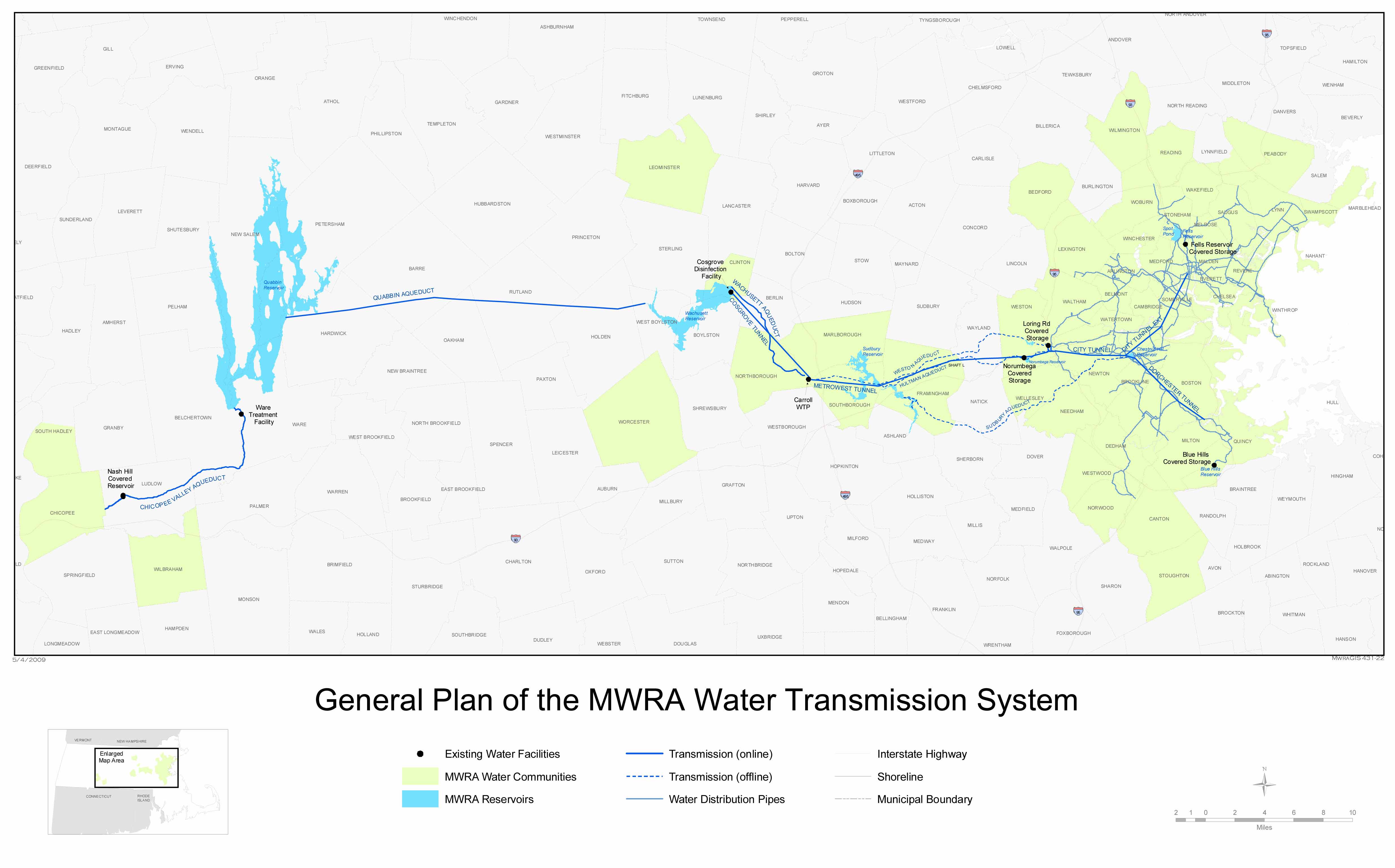
The Weston Reservoir is part of the greater Boston water supply maintained by the Massachusetts Water Resources Authority. It is located in central Weston, with its principal public access point on Ash Street.
| Attributes | Values |
|---|---|
| rdf:type |
|
| rdfs:label |
|
| rdfs:comment |
|
| foaf:name |
|
| name |
|
| geo:lat |
|
| geo:long |
|
| foaf:depiction | |
| location | |
| dcterms:subject | |
| Wikipage page ID |
|
| Wikipage revision ID |
|
| Link from a Wikipage to another Wikipage |
|
| Link from a Wikipage to an external page |
|
| sameAs | |
| shore |
|
| dbp:wikiPageUsesTemplate | |
| thumbnail | |
| area |
|
| basin countries |
|
| cities | |
| length |
|
| location | |
| pushpin map |
|
| pushpin map alt |
|
| type | |
| width |
|
| georss:point |
|
| has abstract |
|
| maximum depth (μ) |
|
| gold:hypernym | |
| dbp:wordnet_type | |
| area of catchment (m2) |
|
| average depth (μ) |
|
| shore length (μ) |
|
| prov:wasDerivedFrom | |
| length (km) |
|
| page length (characters) of wiki page |
|
| area total (m2) |
|
Faceted Search & Find service v1.17_git139 as of Feb 29 2024


![[RDF Data]](/fct/images/sw-rdf-blue.png)

OpenLink Virtuoso version 08.03.3330 as of Mar 19 2024, on Linux (x86_64-generic-linux-glibc212), Single-Server Edition (378 GB total memory, 60 GB memory in use)
Data on this page belongs to its respective rights holders.
Virtuoso Faceted Browser Copyright © 2009-2024 OpenLink Software


![[RDF Data]](/fct/images/sw-rdf-blue.png)
OpenLink Virtuoso version 08.03.3330 as of Mar 19 2024, on Linux (x86_64-generic-linux-glibc212), Single-Server Edition (378 GB total memory, 60 GB memory in use)
Data on this page belongs to its respective rights holders.
Virtuoso Faceted Browser Copyright © 2009-2024 OpenLink Software

.jpg)


.jpg)

![[cxml]](/fct/images/cxml_doc.png)
![[csv]](/fct/images/csv_doc.png)
![[text]](/fct/images/ntriples_doc.png)
![[turtle]](/fct/images/n3turtle_doc.png)
![[ld+json]](/fct/images/jsonld_doc.png)
![[rdf+json]](/fct/images/json_doc.png)
![[rdf+xml]](/fct/images/xml_doc.png)
![[atom+xml]](/fct/images/atom_doc.png)
![[html]](/fct/images/html_doc.png)