About: Floyd's Bluff Goto Sponge NotDistinct Permalink
An Entity of Type : dbo:Mountain,
within Data Space : dbpedia.demo.openlinksw.com associated with source document(s)

![http://dbpedia.demo.openlinksw.com/describe/?url=http%3A%2F%2Fdbpedia.org%2Fresource%2FFloyd%27s_Bluff]()

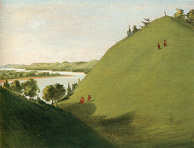
Floyd's Bluff is a hill in southern Sioux City, Iowa that is named for Sergeant Charles Floyd. Floyd, who was the quartermaster for the Lewis and Clark Expedition's Corps of Discovery, was the only fatality during the expedition. The bluff was Floyd's original burial site in 1804, and is now the location of a National Historic Landmark in his honor. The Floyd Monument is located above the east bank of the Missouri River, just downstream from the mouth of the Floyd River. The bluff itself is part of the Loess Hills formation.
| Attributes | Values |
|---|---|
| rdf:type | |
| rdfs:label |
|
| rdfs:comment |
|
| geo:lat |
|
| geo:long |
|
| foaf:depiction | |
| dcterms:subject | |
| Wikipage page ID |
|
| Wikipage revision ID |
|
| Link from a Wikipage to another Wikipage |
|
| Link from a Wikipage to an external page | |
| sameAs | |
| dbp:wikiPageUsesTemplate | |
| thumbnail | |
| georss:point |
|
| has abstract |
|
| gold:hypernym | |
| prov:wasDerivedFrom | |
| page length (characters) of wiki page |
|
| foaf:isPrimaryTopicOf | |
| geo:geometry |
|
| is Link from a Wikipage to another Wikipage of | |
| is Wikipage disambiguates of | |
| is foaf:primaryTopic of |
Faceted Search & Find service v1.17_git139 as of Feb 29 2024


![[RDF Data]](/fct/images/sw-rdf-blue.png)

OpenLink Virtuoso version 08.03.3330 as of Mar 19 2024, on Linux (x86_64-generic-linux-glibc212), Single-Server Edition (378 GB total memory, 59 GB memory in use)
Data on this page belongs to its respective rights holders.
Virtuoso Faceted Browser Copyright © 2009-2024 OpenLink Software


![[RDF Data]](/fct/images/sw-rdf-blue.png)
OpenLink Virtuoso version 08.03.3330 as of Mar 19 2024, on Linux (x86_64-generic-linux-glibc212), Single-Server Edition (378 GB total memory, 59 GB memory in use)
Data on this page belongs to its respective rights holders.
Virtuoso Faceted Browser Copyright © 2009-2024 OpenLink Software


![[cxml]](/fct/images/cxml_doc.png)
![[csv]](/fct/images/csv_doc.png)
![[text]](/fct/images/ntriples_doc.png)
![[turtle]](/fct/images/n3turtle_doc.png)
![[ld+json]](/fct/images/jsonld_doc.png)
![[rdf+json]](/fct/images/json_doc.png)
![[rdf+xml]](/fct/images/xml_doc.png)
![[atom+xml]](/fct/images/atom_doc.png)
![[html]](/fct/images/html_doc.png)