About: 'Arab al-Jahalin Goto Sponge NotDistinct Permalink
An Entity of Type : yago:Village108672738,
within Data Space : dbpedia.demo.openlinksw.com associated with source document(s)

![http://dbpedia.demo.openlinksw.com/describe/?url=http%3A%2F%2Fdbpedia.org%2Fresource%2F%27Arab_al-Jahalin]()

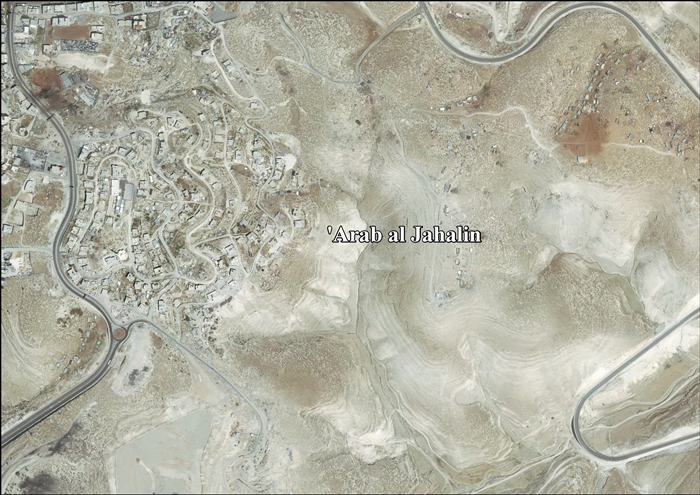
ʿArab al-Jahalin also known as al-Jabal (Arabic: عرب الجهالّين; Hebrew: ערב אל-ג'האלין) is a Palestinian Bedouin neighborhood in the Jerusalem Governorate, located five kilometers southeast of Jerusalem in the West Bank. According to the Palestinian Central Bureau of Statistics (PCBS), ʿArab al-Jahalin had a population of approximately 1,205 inhabitants in mid-year 2006. The village is situated on a hillside outside al-Eizariya and 300 meters away from the Jerusalem Municipal dump. It is located in Area C of the West Bank. While the Israeli government has full control over the village, the populace hold Palestinian IDs.
Faceted Search & Find service v1.17_git139 as of Feb 29 2024


![[RDF Data]](/fct/images/sw-rdf-blue.png)

OpenLink Virtuoso version 08.03.3330 as of Mar 19 2024, on Linux (x86_64-generic-linux-glibc212), Single-Server Edition (378 GB total memory, 53 GB memory in use)
Data on this page belongs to its respective rights holders.
Virtuoso Faceted Browser Copyright © 2009-2024 OpenLink Software


![[RDF Data]](/fct/images/sw-rdf-blue.png)
OpenLink Virtuoso version 08.03.3330 as of Mar 19 2024, on Linux (x86_64-generic-linux-glibc212), Single-Server Edition (378 GB total memory, 53 GB memory in use)
Data on this page belongs to its respective rights holders.
Virtuoso Faceted Browser Copyright © 2009-2024 OpenLink Software


![[cxml]](/fct/images/cxml_doc.png)
![[csv]](/fct/images/csv_doc.png)
![[text]](/fct/images/ntriples_doc.png)
![[turtle]](/fct/images/n3turtle_doc.png)
![[ld+json]](/fct/images/jsonld_doc.png)
![[rdf+json]](/fct/images/json_doc.png)
![[rdf+xml]](/fct/images/xml_doc.png)
![[atom+xml]](/fct/images/atom_doc.png)
![[html]](/fct/images/html_doc.png)